
Built Environment.
Captured. Modeled. Ready to Use.
BIMstream transforms real-world buildings into trusted digital assets. Fast, accurate, and easy to use for planning and management.
Architects. Engineers. Creatives. Under one roof.
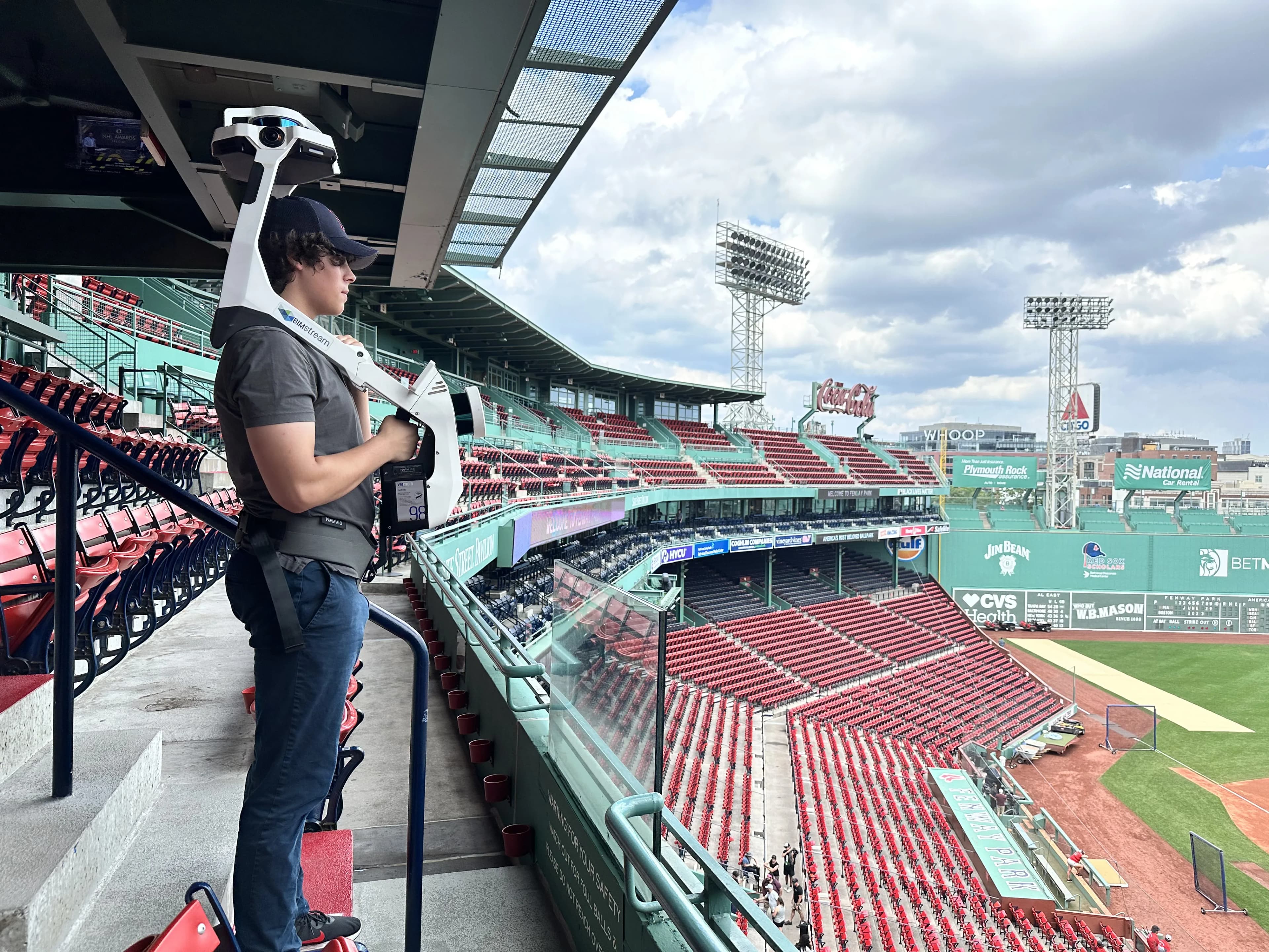
From Land-Based to Aerial, we bring unparalleled accuracy and experience to Reality Capture.
From land-based LiDAR to aerial surveys, we bring the right tools and expertise to every project. Every site is different - we know how to capture it accurately, efficiently, and at exactly the level of detail you need.
100's of Millions + Sq. Ft.
Scanned
Reality Capture
From survey-grade LiDAR to aerial drone flights, we capture every detail above ceilings, across facades, and throughout entire campuses. Precise, efficient, and proven on millions of square feet.
Millions of Sq. Ft.
Delivered as Digital Twins
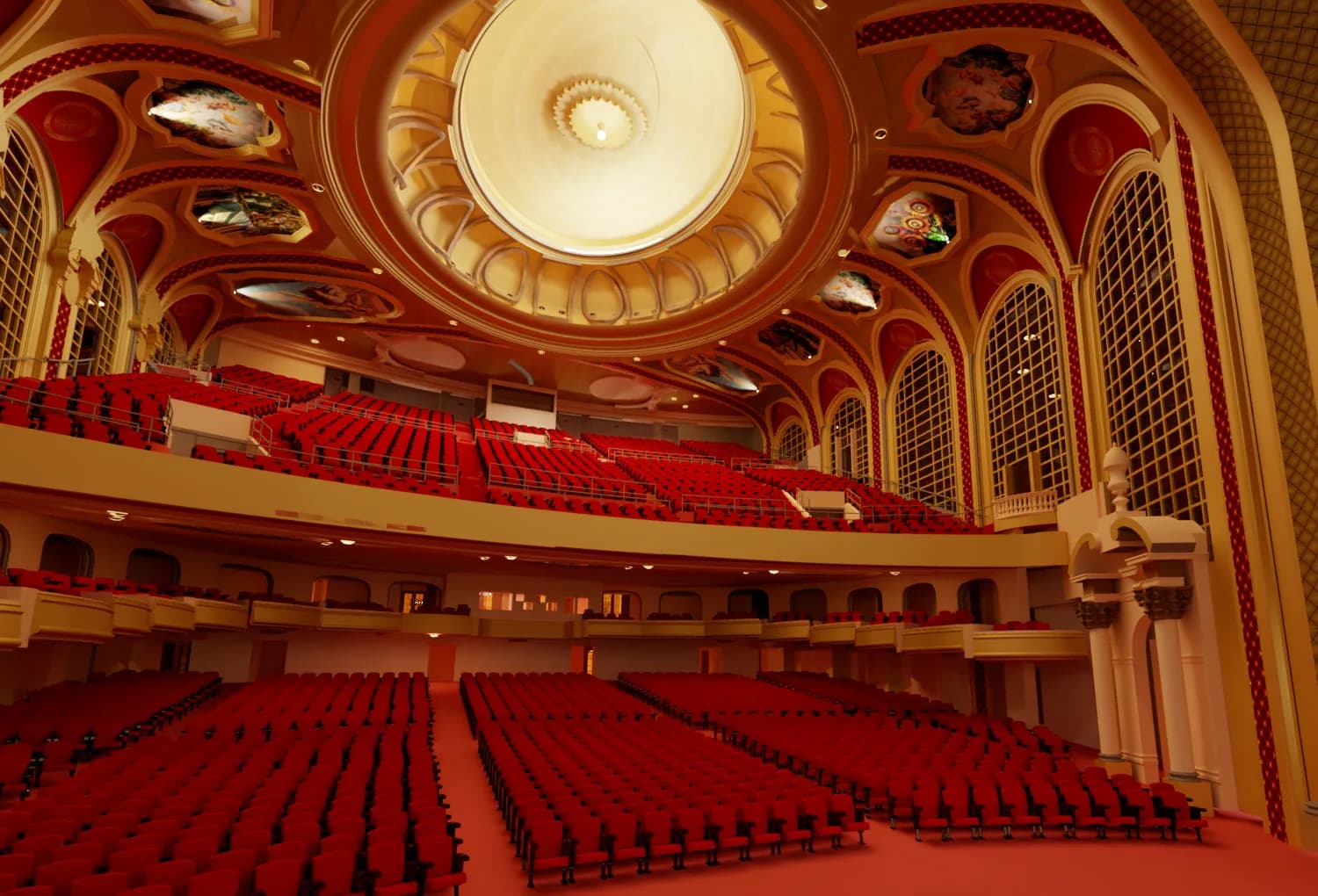
Digital Twin
Our architects and engineers transform raw scans into fully coordinated BIM models, 3D meshes, and VR-ready assets. Accurate, detailed, and ready for design, planning, or operations.

Enterprise Portfolios
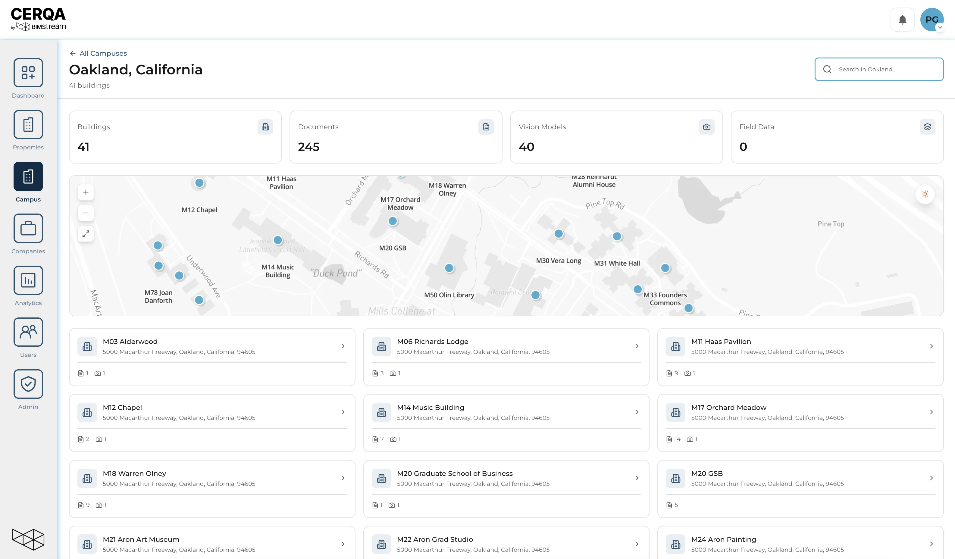
Collaboration
Collaborate
CERQA brings your entire portfolio into a secure, browser-based environment. Measure, annotate, and share 3D models and floor plans instantly, while seamlessly integrating with your existing systems. Scalable, governed, and built for enterprise collaboration.

Production,
Structured For Scale
Deliver
Studio/X extends your internal studio with a fully dedicated, architect and engineer-led production pod. Integrated into your workflow, trained in your standards, and supported by BIMstream QA/QC systems.
100's of Millions + Sq. Ft.
Scanned
Millions of Sq. Ft.
Delivered as Digital Twins
Enterprise Portfolios
Collaboration
Production,
Structured For Scale
Reality Capture
From survey-grade LiDAR to aerial drone flights, we capture every detail above ceilings, across facades, and throughout entire campuses. Precise, efficient, and proven on millions of square feet.
Digital Twin
Our architects and engineers transform raw scans into fully coordinated BIM models, 3D meshes, and VR-ready assets. Accurate, detailed, and ready for design, planning, or operations.
Collaborate
CERQA brings your entire portfolio into a secure, browser-based environment. Measure, annotate, and share 3D models and floor plans instantly, while seamlessly integrating with your existing systems. Scalable, governed, and built for enterprise collaboration.
Deliver
Studio/X extends your internal studio with a fully dedicated, architect and engineer-led production pod. Integrated into your workflow, trained in your standards, and supported by BIMstream QA/QC systems.


Do you need to activate your Digital Twins?
CERQA is a purpose-built platform to host and scale your building data with clarity and control.


